Namibia Satellite Image
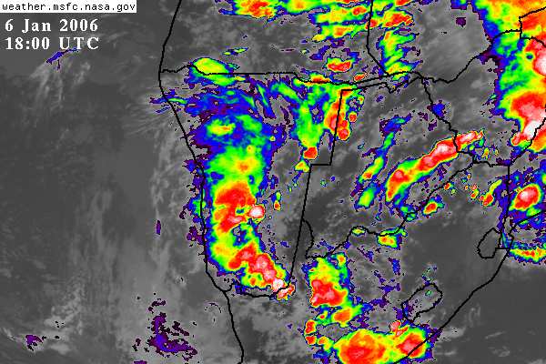
Thought I would post this Satellite image to give you an idea of the thunderstorms we can get here. This image is from the last storm season which brought heavy rain throughout the hole country and caused flooding in many places. Flooding occured in parts of Windhoek. Flooding also accured in Swakopmund, Walvis Bay and Luderitz! Thunderstorms are not common for coastal towns. Mariental in the south of the country was submurged under water as they had to open the Hardap Dam sluice gates to release water just north west of the small town.
.JPG)
No comments:
Post a Comment